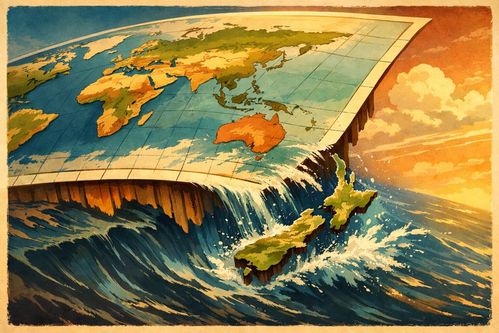
New Zealand doesn’t disappear because the world forgets it — it vanishes because of the stories our maps tell.
Every flat map is an act of compromise. To unfold a round planet onto a rectangle, you must choose where to cut, what to center, and what to push to the margins. For centuries, that choice has been made in Greenwich, with Europe comfortably at the middle and the vast Pacific stretched to the edges like an afterthought.
So Aotearoa drifts to the corner, sometimes literally slipping beyond the frame — not because it is remote in any absolute sense, but because our inherited geography is quietly Eurocentric. The “edge of the world” is a decision, not a destiny.
Yet the moment you recenter the map on the Pacific, everything shifts. New Zealand moves from periphery to presence, from margin to midpoint. Distance remains, but perspective changes.
Perhaps that is the real lesson: places are not lost — only overlooked, until we choose a different way of seeing the world.
Maarten’s Note
When I first started collecting maps as a teenager, I never questioned why the Pacific was always split in two or why New Zealand felt like a cartographic afterthought. Only later — through travel, flights, and staring at in-flight route maps — did I realise how much our “mental geography” is shaped by design choices made centuries ago. In a way, New Zealand slipping off the map is a reminder of why I travel: to challenge the frames we inherit and to constantly redraw my own.
Leave a Reply